Kalypso
Reference Projects
State Flood Center Saxony
| Service: | Conceptualization and technical design of the software and the data management, software development, building of a precipitation-runoff model and precipitation-runoff model integration |
| Duration: | 2004-2008 |
| Technology: | Eclipse 3.0, GML, Observation & Measurement (Open Geospatial Consortium), Apache Tomcat, Java Webservices, XML+XSD (DocBook, xsltproc), deegree GIS |
After the catastrophic impact of the floods in August 2002 the Free State of Saxony decided to establish a modern flood forecasting center (LHWZ). The LHWZ monitors the water table levels and discharges at gauging stations within the State as well as the transmitted data from neighboring countries and states and evaluates these data against the background of precipitation and thaw forecasts from the by DWD (Deutscher Wetterdienst, German Meteorological Service) with respect to possible flood emergence. Thus, flood hazards can be detected ahead of time and those who might be affected can be warned immediately.
During floods the LHWZ publishes among other things flood warnings with further information about the flood trend on the Internet and provides for selected gauging stations comparisons of calculated flood predictions and measured values of the current water table levels and discharges. Telephone and video-text services complement the information available to citizens.
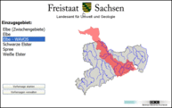
BCE in collaboration with the Technical University of Hamburg-Harburg has designed and installed a software solution for this flood forecasting system. Since 2005 successively all Saxon catchments are integrated into this flood forecasting system. Up to 2008 the following catchments were integrated (the model developers are denoted in parentheses):
- Spree (WASY GmbH)
- Weiße Elster (TUHH, BCE, basierend auf Kalypso Hydrology)
- Schwarze Elster (WASY GmbH)
- Elbe (Engineering company Polte)
- Elbe (German Federal Institute of Hydrology, WAVOS model)
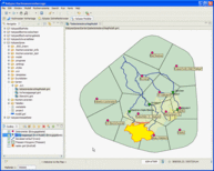
The flood forecasting system is based on KalypsoBASE framework which is a development based on the Eclipse Rich Client Platform (www.eclipse.org). Persistent application of data modeling standards from the Open Geospatial Consortium (e.g. GML) enables users to access various embedded numeric flood forecasting models via GIS functionalities and to depict simulation results in a geographical context. An easy integration of new flood prediction models using data such as time series repositories, external GIS data into the flood forecasting system is supported by a plug-in mechanism. Among others, the time series management system PSICompact from the LHWZ has been implemented using this mechanism.
Integrated functionality
- Uniform storage of all data as OGC-conform GIS or sensor data
- Plug-in approach for integrating other external flood prediction models
- Template-based freely configurable GIS maps and tabular views
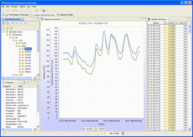
- Template-based freely configurable chart and tabular views of time series
- Wizard-based user interfaces to support work processes
- Plug-in-based approach for integrating other sensor data sources
- Customizable model data management
- Transformation (water table level - discharge transformation) and interpolation as well as aggregation of sensor data
- Determination of areal precipitation values from precipitation gauges (ombrometer data) or precipitation forecasts (raster data) by DWD (Deutscher Wetterdienst, German Meteorological Service)
- Interface to the time series management system PSICompact (PSI AG). PSICompact has been integrated into Kalypso as a time series repository; time series can be accessed from PSICompact and also stored back as well into PSICompact.


