Difference between revisions of "Change Log Kalypso 15.1"
Gernotbelger (Talk | contribs) (→KalypsoHydrology) |
Gernotbelger (Talk | contribs) (→KalypsoHydrology) |
||
| Line 36: | Line 36: | ||
| valign="top" width="50%" | Error handling and validation of all model data has been improved in many little ways such as | | valign="top" width="50%" | Error handling and validation of all model data has been improved in many little ways such as | ||
* validation of complex model data (e.g. the unit hydrograph definition) within the user interface | * validation of complex model data (e.g. the unit hydrograph definition) within the user interface | ||
| − | * more and | + | * more precise and meaningful error or warning messages during simulation |
| | | | ||
|- | |- | ||
Revision as of 19:37, 3 February 2015
Changes since: Kalypso-13.12 (see Change Log Kalypso 13.12)
Contents |
Kalypso Platform
Items that improve Kalypso in general.
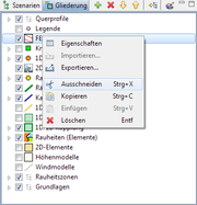
| It is now possible to copy/cut and paste layers in the outline of the map view via it's context menu.
This allows for example to quickly rearrange layers into sub-folders. The copy/cut/paste functions are restricted to layers that have been added by the user. |
|
| The import of projects of older Kalypso versions has been made smarter in such a way that Kalypso now automatically checks if a dataset is outdated when opening a project.
In this case Kalpyso informs the user that the project must be updated and does so after confirmation. |
KalypsoHydrology
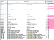
| The comparison of scenarios, which has formerly been part of the functionality for merging scenarios has been reworked and is now a separate feature.
It is now possible to compare arbitrary scenarios via the context menu of the scenario view. The results of the comparison are exported as Excel workbook. The operation compares all relevant model elements by their properties such as:
|
|
| It is now possible to export maximal values of result timeseries (currently only node discharge and volume is supported) from the result management view. This export replaces the former 'statistics result'. The results are exported as Excel workbook and contain the results for all nodes of all selected result datasets, i.e. the export of multiple simulations at once is possible.
An additional sheet in the excel workbook shows the maximum of all exported simulations and the information at what simulation this maximum is reached. This greatly facilitates determing the relevant variant of simulation sbased on design rainfall. |
|
Error handling and validation of all model data has been improved in many little ways such as
|
KalypsoWSPM
| Empty, please replace me with a real entry. |
Kalypso1D2D
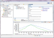
| The timeseries import has been replaced with a trimeseries management similar to the timeseries management in KalypsoHydrology. The timeseries management allows to group timeseries by stations and to enter some metadata associated with these stations. |
|
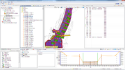
| A new 'cross section management' has been introduced that replaces the former functionality for importing sections into 1D2D and displaying them in the map.
Funtionality of the cross section management includes:
All cross sections are automatically displayed as layers in the map. |
KalypsoRisk
| Empty, please replace me with a real entry. |


