Change Log Kalypso 2.1.0

From KalypsoDev
Revision as of 11:48, 22 December 2008 by Gernotbelger (Talk | contribs)

Jump to: navigation, search

Changes since: Kalypso-2.0.1 (Change_Log_Kalypso_2.0.1)

Contents

General

Bugfixes

ChartView: A lot of switching between several charts leads into slowing down the application.
Timezones: Changes in the Kalypso preference page do not have any effect.
Coordinate system: Coordinate projection changes z-values in a wrong way.
ZML Import: Import Temperature ZML's with negative temperature values does not work.
Network Connections: Preference Page 'Network Connections' is missing, preventing configuration of a network proxy.

New and Noteworthy

Memory Consumption: Improved default arguments for the JavaVirtualMachine in order to return memory back to Windows. This helps especially after 1D2D calculation.

Kalypso Hydrology

Bugfixes

ZML Import: Import ZML's from clipboard like (Zeitflächenfunktion) via the 'Diagram'-Dialog: all double entries without digits (like 2,000) are ignored.

Kalypso WSPM

Bugfixes

Demo-Project: The Übersichtskarte.gmt does not work if user choses a project name that is not 'WSPMDemo' (due to absolute pathes).

New and Noteworthy

New Calculation Model: New version 2.1.4.1 of Kalypso-1D.exe is shipped with Kalypso.

Kalypso 1D2D

New and Noteworthy

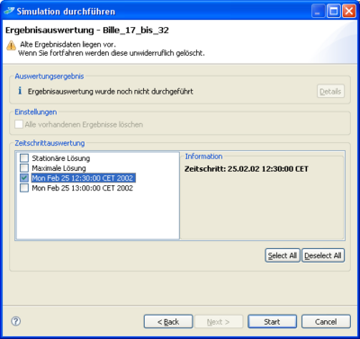
Result Processing: user can select the timesteps he wants to be processed
Result Processing: Processed data is getting stored in zip files. Screenshot-1d2d result selector page.png
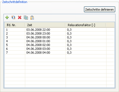
Control Dialog: Toolbar buttons for timesteps management (add, remove, interpolation, copy/paste) are available now.

Ordinal numbers of the timesteps are auto-updated now after recordset change. It is defined as swt optional extension, so it affects opservation only if is defined (not by default). Timestep toolbar can be customized with GFT file, standard actions are configurable at single button level. "Add" and "interpolation" actions are not applicable to any type of observation, so they are implemented as commands specific for 1D2D control model timesteps. For te existing 1D2D control models, adaptation for the ordinal number component and wrong sort component definition fix is implemented at model loading level; 1D2D control model is versioned model now.

Timesteptabletools.png
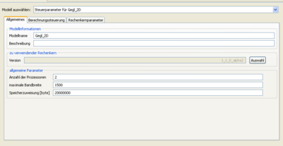
Calculation Core: Intel® Math Kernel Library 10.0 [1] (for big models only with benefit) implemented. User has to give the no. of processors to be used. Requires CalcCore Version 1.1.x ControlPanel MKLControl.png
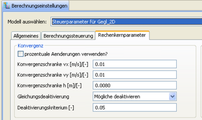
Convergence Tests: Introduced usage of relative or absolute changes. User can use checkbox next to convergence criteria borders. Support with CalcCore Version 1.0.4 UsePercentageOfChange.png
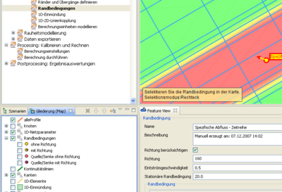
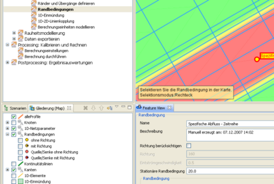
Element inflow: Introduced different types eather with or without directio fix. User can check the box and give then an inflow direction and the inflow velocity. For map display the colors of the element inflows were changed and the arrow is optionally shown. Circle diameter of boundary conditions and inflow conditions is reduced a bit. (Until now old models are only handle rudimentary by starting a calculation, what causes a change of the new properties of old element inflow features. This will change later by a model version check) element inflow with given direction

SourceSinkWithDirection.png element inflow without direction (real source/ sink) SourceSinkWithoutDirection.png

Bugfixes

Coordinate Projection: project coming from different source coordinate system is not getting projected (FE-nodes).
Timestep table: the table of iteration timesteps in the control dialog was sometimes empty, even if entries existed.
Restart: remember time dependent results and write them out for proper restarting in pure 2D applications;
Calculation control model: status of restart option button doesn't take effect for calculation. Restart mode is always active.
Result processing: already processed time steps from previous calculation are always deleted
River Channel Generator: generator did not consider different coordinate systems


Kalypso Flood

Bugfixes

Coordinate Projection: water level tins with different source coordinate system are not getting projected
Personal tools
Namespaces

Variants
Actions
Navigation
Manuals
Toolbox