Changes since: Kalypso-2.2 (Change_Log_Kalypso_2.2.0)
Trac Reports
* Changes (closed tickets): http://sourceforge.net/apps/trac/kalypso/report/22
* Known-Issues: http://sourceforge.net/apps/trac/kalypso/report/23
* Known-Issues (still open from 2.2): http://sourceforge.net/apps/trac/kalypso/report/21
Kalypso Platform
Items that improve Kalypso in general.
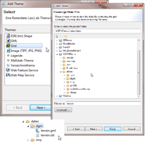
| Adding a new grid layer to a map now creates the necessary data and style files if they do not yet exist.
|
|
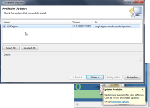
| Kalypso now supports auto update.
|
|
Consumability / Reliability
Items that make it easier for users to get Kalypso, install it on their systems, and configure it for their use.
| Empty, please replace me with a real entry.
|
|
KalypsoHydrology
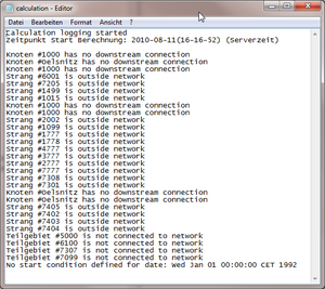
| Simulation log file ('calculation.log) now contains more information about preprocessing during simulation run (e.g. warnings about incorrect net).
|
|
KalypsoWSPM
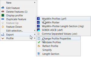
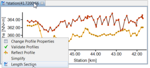
| All profile manipulation and profile export functions have been reworked. All these functions are now using the same profile chooser dialog and can be used wherever profiles are available (profile list, map, reach, ...).
|
|
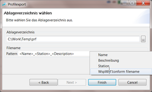
| PRF-File export allows for filename patterns for exported files. Other smaller improvements.
|
|
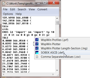
| SOBEK-Ascii export writes profiles as SOBEK profile.def format (only terrain is exported as XY-profiles at the moment).
|
|
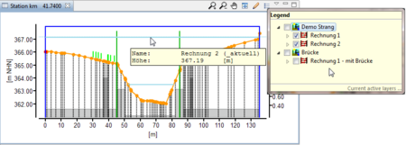
| Create a length section from any selection of profiles without calculation. Other improvements to length section (showing bridges, weirs, better colors, ...).
|
|
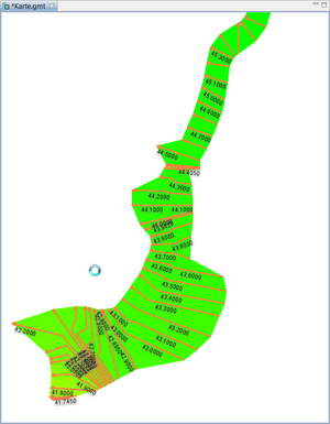
| The (already existing) triangulated waterlevel is now automatically added as layer to the result map. It is displayed with a generated color map.
|
|
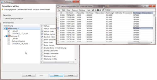
| CSV Export of profile points allows to add calculation results. Every column of the result table can be joined to the exported csv.
|
|
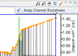
| It is now possible to deactivate the automatic adaption of roughness within a channel.
|
|
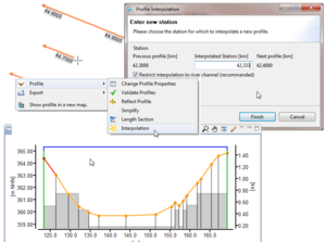
| A new profile can now be added by interpolating two adjacent profiles.
|
|
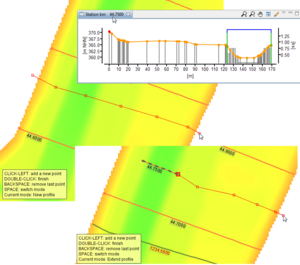
| It is now possible to create a new profile or to extend an existing one using data from a digital terrain model. After digitalizing the profile line on the map, the ground level is obtained from the dtm and added into the profile. Additionally, the retrieved profile points are simplified via the Douglas-Peucker algorithm.
|
|
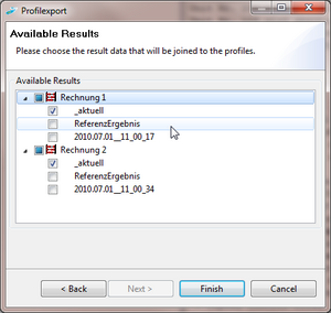
| When exporting profiles to .prf format, the user may now choose result data to be added into the .prf files. The results will be written as waterlevels and discharges, suitable for presentation in WspWin Plotter.
|
|
| It is now possible to show the water levels of a KalypsoWSPM calculation in the profile view.
|
|
| Lengthsection Result-Layer shows Weir,Bridges and Culverts
|
|
Kalypso1D2D
| Empty, please replace me with a real entry.
|
|
KalypsoFlood
| Empty, please replace me with a real entry.
|
|
KalypsoRisk
| Empty, please replace me with a real entry.
|
|


